2007 Camping Trip
Posted Sunday, October 21, 2007
We're not sure exactly how many miles we drove, because one day someone reset the trip odometer we were using to measure that. We use the other trip odometer to measure the number of gallons of gas used after each fill up because…. Naw, that's a long story and I'm not going there. Anyway, we were able to pin it down to about 5120 miles.
2007/09/10
We took the truck to the Boise Chevy dealership early this morning for service. We went there rather than a quick lube joint since I had discovered two small loose straps under the truck. (I think they may have been loose since we had air bags installed on the truck about 2 ½ years ago.) I figured the quick lube guys wouldn't know where or how to hook them.
By this time we had accumulated lots of bugs, so I asked the service advisor if they did a hand wash. He said that it was complimentary. I said that I need the camper done, too. He said, "No problem. We'll do that, too." Turned out to be a good place to go.
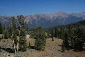
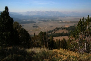
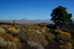
Our destination was Craters of the Moon National Monument in southeastern Idaho. But we decided to take a side trip and drive north up to Galena Pass (8,990 ft.) where we hoped there would be a sweeping view of the Sawtooth Mountains & Valley, without too much smoke.
At the pass the sky was fairly clear:
But the Sawtooth Mountains and Valley were seen dimly through smoke:
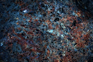
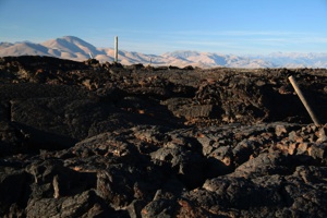
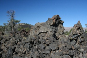
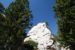
We backtracked and headed to Craters of the Moon. Here recent (2,000-15,000 years ago) lava flows cover a very large area, but there is no large volcano. Instead, lava and small cones issued from a 52-mile long fissure, known as the "Great Rift." We picked out a nice campsite in the monument campground, and decided which trails we would take.
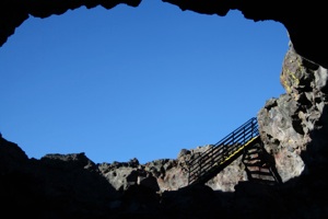
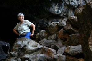
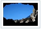
We drove the 7-mile loop road and hiked to and through Indian Tunnel lava tube (about 1 1/3 mile). Now there is a very large lava tube off a dirt forest service road near Flagstaff, which looks like a subway tunnel inside, with a flat floor and curved ceiling. There are places inside where one could build a large house. Indian Tunnel is not nearly as large.
It has several roof collapses so it's not necessary to carry flashlights or lanterns inside, although at one point it was fairly dim. We thought it would be interesting, and it didn't disappoint. The tunnel is entered via stairs:
This rock was just inside the entrance:
We weren't sure if we would walk the entire length of the tunnel, since the description read, "If you are willing to scramble over a large rock pile and climb through a small opening…." Most people were turning around at the rock pile, but it turned out that we "walked" over the pile:
And there were some large rocks that could be stepped on to pop out this small hole:
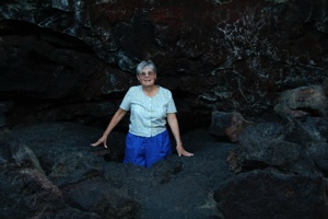
Is that cool, or what? But uh, oh. The "unimproved surface trail" was this:
We didn't read this part: "Follow the … posts across the lava…." (Hee, hee….) But we were wearing good shoes, so no problem. We had been wanting to buy some hiking shoes for a long time, so just before we left Arizona, Julia did some internet research and found some reviews. We picked out a couple which we thought would be satisfactory, and went to a nearby sporting goods store, where we both found the shoe at the top of our list. (Julia got hers on sale.) Not only did they feel really good in the store, they were fantastic on the trail. We had worn them only a few times, like here at Indian Tunnel, before we put them on and hiked a 5-mile trail at Yellowstone National Park, with no problems. They are Merrell Pulse II and we recommend them highly.
2007/09/11
In the morning we awoke and found a Hallmark camper in the site behind ours:

Not only was their truck the same color as ours, their waste water bucket was almost exactly the same, too. (Hee, hee….)
Dwarf buckwheat plants grow regularly spaced in the cinders because their extensive root systems compete for water:
We hiked up Inferno Cone (1/2 mile round trip … course we walked around a lot on top) where we found much more vegetation than could be seen from the bottom:
We took the Devils Orchard trail (1 mile):
Our Caters of the Moon photo gallery:
After visiting the Visitor Center, we headed for Yellowstone National Park. We camped just outside the west entrance, in a nice forest service campground near West Yellowstone, MT. There were many sites that weren't taken, but we knew that would not be the case tomorrow in the national park.
2007/09/12
We entered the park early and drove to Norris Campground, about 30 miles, stopping once to take this photo:
We chose Norris because it is as convenient as any, and is the only first-come, first-served campground with flush toilets. We selected a nice site and backed in. In order to hold the site, we walked to the reservation board, paid for two nights, returned to the site and placed our stub and a small "reserved" sign on the campsite post. Each campground is different, and everyone has to follow the rules. Sure.
Now, we saw many beautiful things at Yellowstone. The variety of thermal features is amazing. There are rivers, falls, canyons, lakes, animals…. There's something for everyone. And all of these things have names. We have lots of photos, and we can look at the time stamps and tell generally where they were taken, but can't tell Prospect Spring from New Blue Spring. So I'll try to tell you where photos were taken, and if I think I know the name of something, I'll tell you. But if I get it wrong, it's Julia's fault.
We drove about 20 miles north to Mammoth Hot Springs, stopping at Golden Gate:
and a short loop drive, not on the map, with interesting rocks:
Here's our gallery from the west entrance to Mammoth Hot Springs:
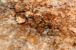
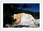
This photo is from Mammoth Hot Springs, where calcium carbonate is deposited to form travertine terraces:
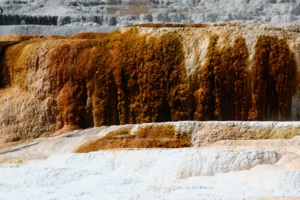
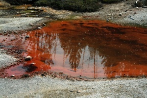
Thermophiles (heat-loving organisms) create the beautiful colors in the springs. Yellow thermophiles grow in the hottest water and orange, brown, and green ones thrive in cooler water:
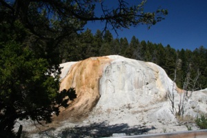
This is Orange Spring Mound (when you see our photo album you'll find out how come I know):
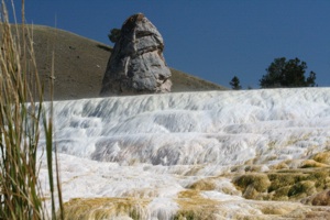
The feature in the top of this photo is Liberty Cap:
We drove the one-way Upper Terrace Drive and walked all the boardwalk trails.
Here's our photo gallery:
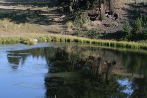
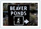
Now we've been to lots of out-of-the-way places, but we've never seen a beaver dam. At Mammoth Hot Springs there is a 5-mile trail to several beaver ponds, so we jumped at the chance. We didn't expect to see any beavers, but we thought we would see several dams (we saw one, sort of) and some beaver lodges (we didn't).
I remember reading about beavers in elementary school. There were drawings in the book showing beavers everywhere. Some were cutting down trees, some were swimming, and some were expertly building a long, neat dam.
Here's Julia on the trail:

Here's one of the beaver ponds:
And here's the only dam that we saw (the others were covered with cattails and other greenery):
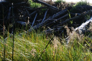
I guess some beavers are neater than others. (Hee, hee….)
We had taken a side trail to locate a dam, and when we returned to the main trail we saw another couple. They asked, "Did you see the bears?" "No, where?" And there they were, a mother black bear with one cub on one side of the trail, and another cub on the other side. This was where we had passed through minutes before.
Another couple approached from behind the bears, stopped and watched for a while, then detoured around the pond. The six of us watched for quite a while. They were within camera range, but only humps were visible, as they foraged in the brush. When we left the area, they still had the trail shut down.
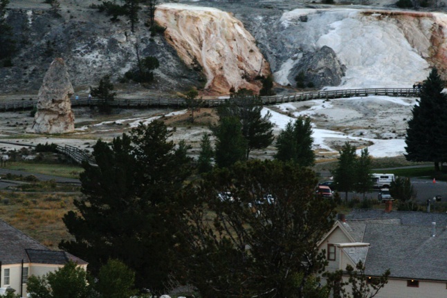
We were starting to get pooped and were wondering, "Surely we've gone 5 miles by now." Then we crested a ridge and Mammoth was below us. We thought we saw our camper in the parking lot, so I took the photo below with the 300mm lens. It was getting on toward dusk and lights were on in the building in the bottom right side of the photo. We didn't know if it was our camper or not until we returned home and opened the photo on the computer. (It is.) Liberty Cap is seen at the left:
This is the Beaver Pond Trail gallery:
It was almost dark when we returned to the campground. The sign at the entrance read, "Full." There were giant campers crammed into small campsites, sticking out into the one-way road. Then we rounded a curve, and there in our campsite was a big fifth wheel camper. We couldn't believe it. Julia's reserved sign was still on the post.
I let the truck idle in the road, lights on, and knocked on the camper door. A fellow, perhaps a little older than myself, opened the door. I told him that he was in our site which we had paid for early in the morning, and that he would have to leave. He said no, it was his and he had arrived about 11:30. I said I was there much earlier and he would have to vacate.
I got back into the truck and waited a couple of minutes. I didn't expect anything to happen, and it didn't.
I got out and banged on the door this time. By this time I was starting to attract the attention of other campers. He opened the door again. I said, "Listen buddy, I'm not kidding. This is my site and you're going to have to leave." He said it was his site and to "…go ask that ranger lady because she had said he could camp there." Oh, brother.
I got back in the truck and we decided that we would have to find a park ranger. As we were driving away, Julia asked if our registration stub was still on the post. I said that one was there, and if it was ours, we should retrieve it. I circled around again, and of course, it was our stub.
I really pounded on the door this time. I showed him the stub and Julia's little reserved sign. He said, "Oh, you just put that there now." Oh, good grief.
We drove to the little ranger station at the entrance to the campground, and, of course, there was no one there. There was a pay phone there (cell phones don't work at Norris), and we decided to call for a ranger, but we couldn't find a number to call.
I decided to call 911. A male voice answered. I said that I really didn't have an emergency, but I needed to contact a park ranger as someone was in my campsite and wouldn't leave. He said I had called the correct number, asked for my site number, and told me to wait at the site.
We returned and I let the truck idle in the road. It was dark by now. I got out and talked to the campers across the road for a while, but we were still in our shorts from hiking, and it was getting kinda cold, so I got back in the truck. It took quite a while for the ranger to arrive.
I showed her our stub and little reserved sign and explained the situation. She went over and knocked on the camper door, and asked him to come out. The wife came out, too. He gave his side to the story. The ranger asked him if he had a registration stub. The wife said it was in the truck and she went to look for it. Idiots. After a bit she returned with a stub, and the ranger asked them to return to the camper.
Man, this story is getting long.
The ranger told me that they were having problems like this and that the campground was full (duh) so she would give permission for one of us to camp in the parking lot by the restroom. I guess she figured she would talk to me since he was in the site and I wasn't.
I knew he wasn't going anywhere, so I said that we would volunteer to stay in the parking lot (Actually when I think about it now, we left the parking lot and went and camped by ourselves. Next to a restroom. In the handicapped parking slot. Hee, hee….) but he would have to vacate so we could camp in our site the next night, and any additional nights that we wished. (We stayed four nights at Norris.)
She went over, knocked on his door, and went inside. We sat in the truck. Ten or twelve people watched from their campers. (Hee, hee….) She was gone a loooong time.
Finally she came out and over to the truck and said that he had agreed. I said, "You must have had a hard sell." She said yes, but she had talked him around. So we went over to the parking lot, had a peanut butter sandwich, and went to bed.
2007/09/13-15
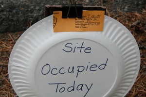
We decided to go to our site, put a large reserved sign on the post, but not the registration stub, visit the Norris Geyser Basin, then return after the fifth wheel was gone (we weren't sure he would be) to put the stub on the post. But when we rounded the corner, the site was empty. We backed in & Julia made a sign on a paper plate:
I've lumped three days together (Thursday, Friday, and Saturday) because I'm going to post photos in a better sequence than they were taken.
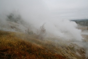
We drove the short distance to Norris Geyser Basin, which I think I enjoyed more than the other thermal areas. It was probably the weather conditions that made it so. It was early morning, clouds hung low over the area, the humidity was high, and it was cool and windy. We wore our heavy winter coats.
There were clouds of steam everywhere. We enjoyed walking through the warm steam. Sometimes the wind would shift and blow the steam where we were standing or walking, cutting visibility to a couple of feet. It was great. Course, when we emerged we smelled like rotten eggs! (Hee, hee….)
One area is called Porcelain Basin and another is called Back Basin. We walked all the trails and boardwalks, about two miles total:
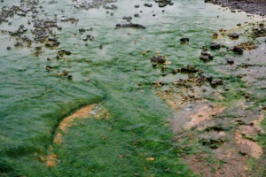
Algae are the dominant life forms in the green mats here:
Here's our Norris Geyser Basin gallery … in the last photo you can see that the clouds are beginning to lift:
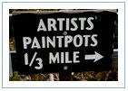
We drove a short distance south and took the one-mile Artists’ Paintpots trail:
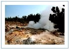
Beryl Spring is nearby right next to the road, and we drove by it several times during our 4-day stay. There always seemed to be huge clouds of steam coming from the spring:

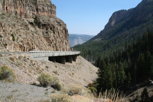
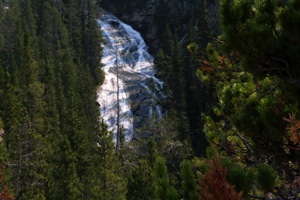
We returned to Norris and turned east toward Canyon Village. We drove the Virginia Cascade drive, along the Gibbon River:
This gallery has photos of the features we visited after Norris Geyser Basin: