2007 Camping Trip
Posted Monday, October 15, 2007
Saturday we went to the grocery store to get our flu shots. (We also purchased some groceries. Hee, hee….) Julia bought 4 large bags of Gala apples which were on sale for 49 cents a pound, and she will make some apple butter. The apples hadn't been placed on display, but were still in their shipping boxes, which were marked Chelan, Washington. Now that we have been there, we know how to pronounce it!
2007/09/06
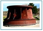
On our way to Grand Coulee Dam, we stopped by Chief Joseph Dam, read the outdoor displays, walked a labyrinth ... see http://www.drweil.com/drw/u/id/ART02020 (this was a grassy one, so a little different from Dr. Weil's), and walked a short trail along the cliff for views of the dam. A turbine was on display:
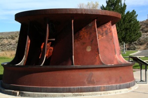
Here in Arizona we are used to visiting tall dams in narrow canyons. Standing on a cliff overlooking Grand Coulee Dam, it's hard to believe that the dam is almost a mile long!
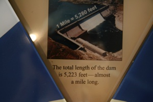
Displays in the Visitor Center showed dams, water projects, and hydroelectric projects throughout the west, including Arizona.
The Chelan to Spokane Gallery:
Spokane's 95-acre Manito Park, located in a residential neighborhood, is absolutely amazing! It's really a beautiful botanical garden, and, like most city parks, it's free! Manito is a Native American word meaning "a supernatural force that pervades nature." If English could be shortened up like this, I'd be through with this narrative by now.
These are the principal gardens:
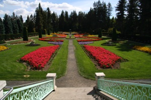
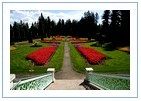
The Duncan Garden (originally called the Sunken Garden) is a formal annual garden:
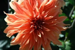
Here's a photo from the Dahlia Gardens:
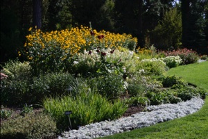
The informal Perennial Garden provides a nice contrast to the Duncan Garden:
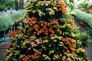
The Conservatory houses large tropical plants and a wide variety of plants are found in the associated greenhouses:
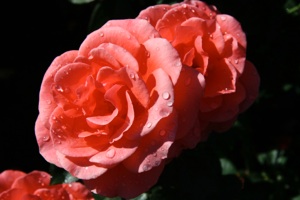
There are over 150 varieties in the Rose Hill garden:
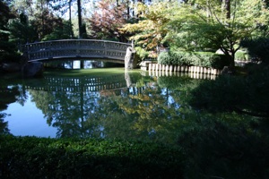
In 2004, The Journal of Japanese Gardening ranked the Japanese Garden 24th from more than 300 public Japanese gardens:
The lilacs weren't in bloom at the time of our visit, but this garden contains named cultivars from 23 distinct species.
Of the many photo Galleries that I have posted, this one is certainly in my top six favorites:
We spent the night at Riverside State Park, just north of Spokane. We had called to update our reservation to a site with electricity (got the last one) so we could charge our camera batteries. This was our first extended camping trip with our digital camera, and although we have 3 batteries, we found that we needed to recharge them every 4 days or so. We won't have to be concerned with this on our next camping trip, since we have purchased an inverter, so we can charge batteries from our truck's auxiliary 12-volt power jack. It's a lot cheaper than buying Cannon's 12-volt charger, and it can be used for anything.
2007/09/07
After we broke camp, we drove a short distance to this view of some interesting rock formations in the Spokane River:
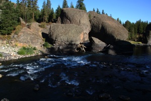
There is also a foot suspension bridge there.
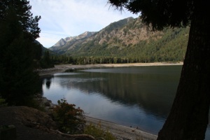
We then drove generally south from Spokane, from Washington to Idaho (US 95 there) and back to Washington again, then south to Wallowa Lake State Park (wa-LAW-wa) at the foot of the Wallowa Mountains in Oregon.

This is a very nice state park in large timber at the end of the lake:
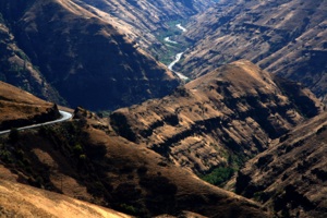
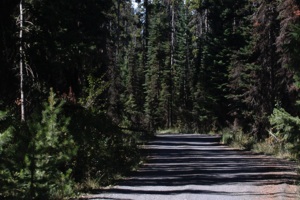
The route we took is quite scenic. And, yes, after I took this photo, we drove down this road:
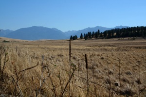
Although we didn’t know it when I took this photo, we're pretty sure these are the Wallowa Mountains, and Wallowa Lake is located at the "V" in the mountains, just to the left of the trees:
Here's the photo Gallery for the day:

2007/09/08
Our destination on this day was Hells Canyon, a rather inaccessible canyon of the Snake River, which divides northeastern Oregon from Idaho. Most brochures describe Hells Canyon as the "deepest gorge in North America."
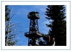
We decided to approach from the Oregon side, and drive to "…the breathtaking vista at Hat Point Overlook." The Hat Point road was an interesting drive, but we think the vista is a bit over-hyped. And unfortunately the 360 view at the end was greatly diminished due to heavy smoke in the area from unseen wild land fires. Also fire had recently burned through the vista area, but the wooden fire tower was saved:
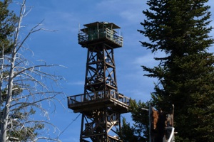
The rocks at the base of the tower are whitewashed and look like this from the tower's observation deck:
The wooden portion of concrete picnic tables in the area had burned, and new bench and table tops were stacked in the area, but not yet installed.
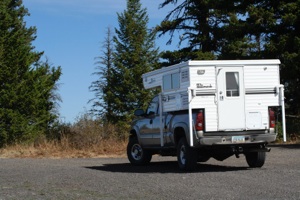
I've just looked through some of our literature, but I couldn't quickly find the length of the Hat Point road, but I think it is 22 or 23 miles. (Same distance back. Hee, hee….) Here's the truck parked at Hat Point:
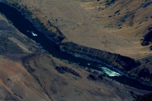
Only a portion of the Snake River can be seen from Hat Point (we were disappointed), and in this photo a boat approaches some rapids:
The Hat Point road is a typical forest service dirt/gravel road (except the first six miles or so, which are a 6% to 8% grade, single lane with turnouts), in relatively good condition. After driving about 2 hours and 45 minutes, we came to this vista of the Wallowa Mountains:

When we were there, looking at the descriptive sign (it's included in the photo album below) we thought Wallowa Lake was at the right-center of the photo, at the base of the mountains under the highest peak. But now, when we compare the sign with the photos, we're not so sure. (Hee, hee….) What do you think?
At the top of the grade, the road passes through a beautiful forest:
Read the top portion of this sign, then look at the next photo:
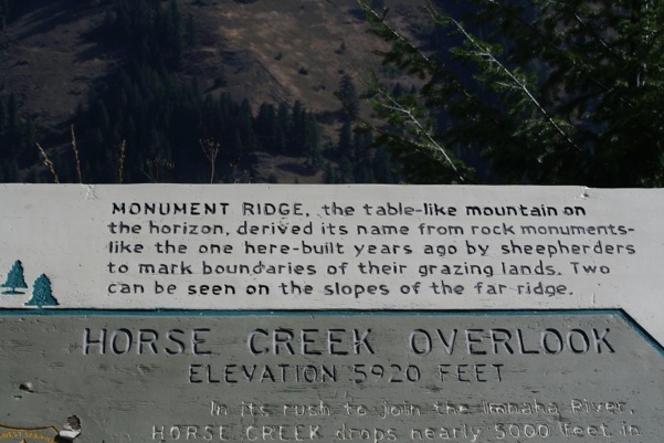
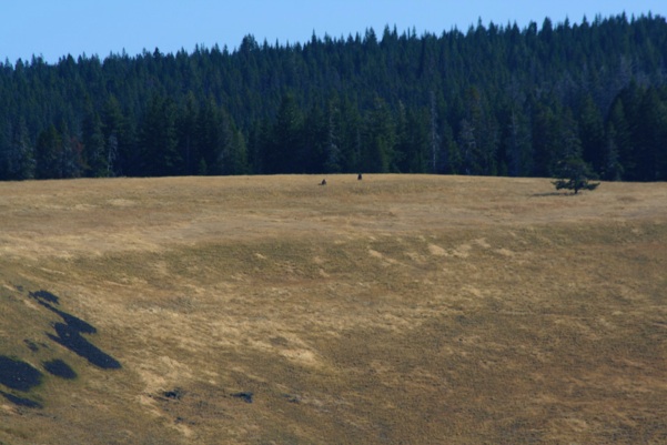
Using binoculars, we looked for the monuments for quite a while, before finding them. They are in the center of the photo below, taken with a 300mm lens, in the grassy area just below the tree line:
The photo Gallery below also includes a smoky view of the Seven Devils Mountains (taken from Hat Point), which follows a photo of a descriptive sign:
We camped in this campground, operated by Idaho Power:
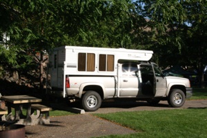
Notice the right front hubcap is missing. It was there the night before, so we probably donated it to the Hat Point road. I think either the Discount Tire guys in Flagstaff didn't screw on the fake bolts, or torqued them too tight and striped them.
2007/09/09
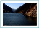
We drove up the Idaho side of the Snake River and took photos of Hells Canyon Dam and Reservoir (pretty cool road along a steep mountain).
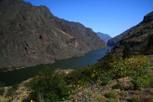
We drove on a curvy road out of the canyon, then were treated to scenes like this:
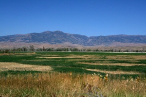
We decided to stop early and stay in Boise, so we could do our wash in the campground laundry, and take the truck in early the next morning (Monday) for an oil change.
The smoke was very thick in Boise, and the nearby mountains were barely visible. I started having some throat irritation, so I doubled up on the antihistamines and began Zycam and echinacea, just in case. As we drove east, the amount of smoke lessened, and the irritation went away in a couple of days. We still encountered some smoke in Yellowstone National Park, however.
Today's photo Gallery: