Carroll’s Photos


2007/09/19 continued
This is a view of Sheep Creek Bay. Sheep Creek enters Flaming Gorge Reservoir at the left:
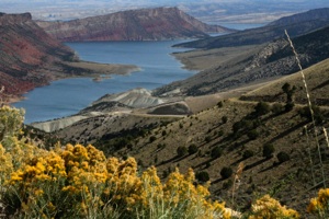
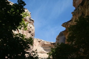
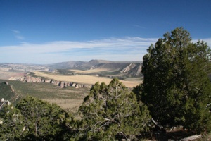
Some viewpoints are really high above the lake:
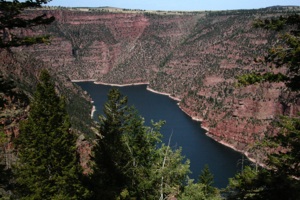
A short photo album of Flaming Gorge:
2007 Camping Trip
Page 6


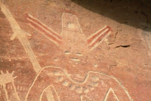
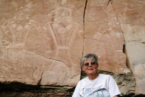
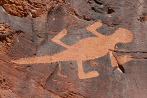
We secured a campsite in Vernal, and then drove west to Dry Fork Canyon, to see the petroglyphs there on the canyon walls:
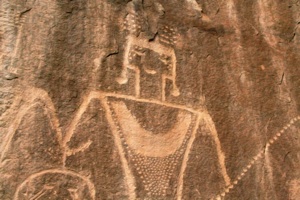
These figures date from the Fremont culture (1-1200 AD), and are amazing due to their quantity, size (up to nine feet high), and accessibility.
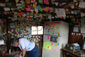
The petroglyphs are located on private property; however, a sign-in shack and small parking lot are located a short distance from the main road. There are walking sticks there for you to borrow:
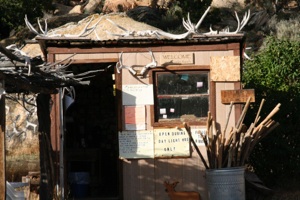
Inside the shack you can pay your small parking fee, help yourself to water or a soda from the fridge (payment on the honor system), and leave a comment on a sticky:
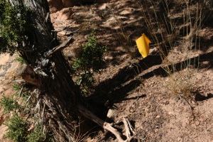
The trail is marked with little flags and begins right behind the shack:
The only question is which way to go: left or right. Based on the comments in the shack, we think some people went right, didn't find much, and gave up. But if you go left … Wow! There is a bear:
This fellow has been dubbed big foot:
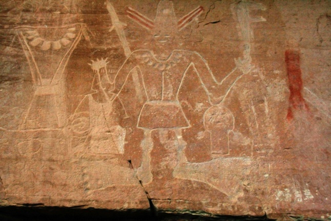
As you can see in the photos above and below, color has been painted on some of the figures:
A short way in we were met by two trail cats, who guided us to the end of the trail and back to the parking lot:

Our Dry Fork Petroglyphs album follows below. These images are chipped into stone with little color. Petroglyphs usually are seen on rocks stained dark with desert varnish (oxides of iron and manganese), so I ran the petroglyph photos in this album through Photoshop, in order to highlight the images. The photo below shows how they really looked, and also shows how large and accessible they are:
2007/09/20
Dinosaur National Monument is located a short distance east from Vernal, partially in Utah and partially in Colorado. One of the world's largest concentrations of fossilized dinosaur bones is found here. The visitor center was built so that one of its walls is a cliff face where thousands of bones are located. Unfortunately, the structure is unsound and cannot be entered. So until the government figures out how to fix it, then actually appropriates money to fix it, very few dinosaur skeletons can be viewed here.
We consider this a must stop, however, since there are other interesting and beautiful things to see.
A section of the road to the Josie Morris Cabin follows the Green River:

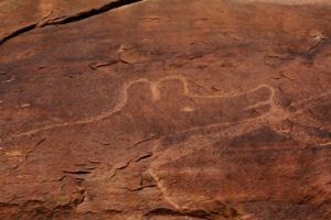
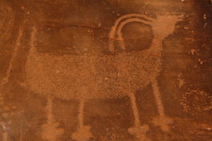
There are many petroglyphs here also. These were chipped into stone with desert varnish, so they are shown here the way they actually looked:
How many lizards can you see on this rock face?
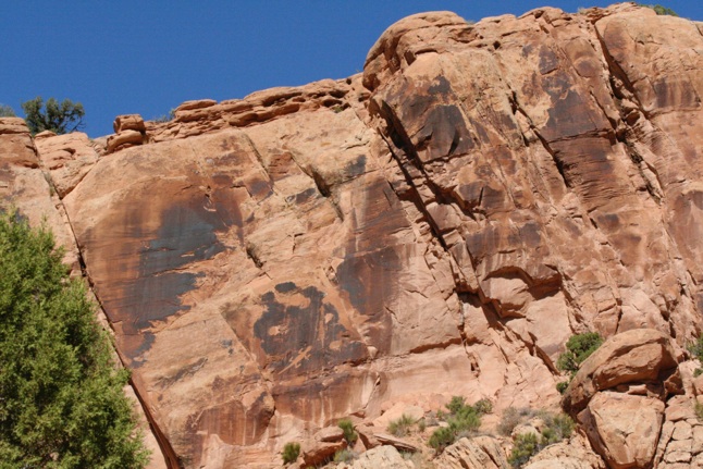
Here's one below:
Now go back and look for some more. (Hee, hee….)
Here are some photos from this scenic drive:
Josie Bassett Morris was a colorful character. She had at least five husbands, supposedly chasing the last one off with a frying pan. She lived the last half of her life alone on her homestead in this secluded area. She built this cabin in 1935:
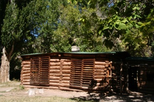
Josie independently provided for herself by raising and butchering animals and canning vegetables from her garden. She brewed bootleg whiskey when she needed cash and occasionally shot deer out of season. She had no electricity, living a 19th century lifestyle well into the 20th century.
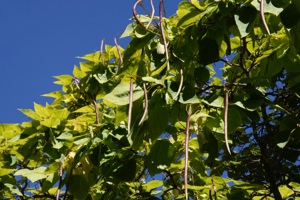
Julia recognized a catalpa tree growing there:
In 1964 Josie slipped on ice and broke her hip while feeding her horse. She died shortly thereafter at the age of 90.
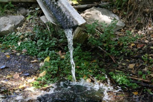
Josie irrigated her trees and garden from a spring on her property:
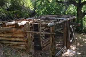
This is Josie's chicken coop:
Here's a short album taken at Josie's cabin:
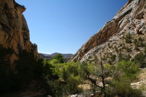
We walked a shady trail into Box Canyon (half mile round trip), where Josie kept her animals. This photo was taken looking into the canyon:
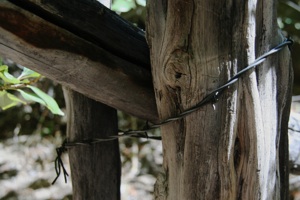
Josie only needed to fence the open end of the canyon to keep her animals there. This photo shows the remains of some of her fence:
This view was taken from inside the canyon, looking toward the open end:
Box canyon album:
We then backtracked out of the national monument, drove east on US 40, and then drove into the canyons section of Dinosaur National Monument via Harper's Corner Scenic Drive.
The road ends at Harpers Corner, named after a local rancher who used it as a natural corral. Why it's called a corner, we don't know, because it's really a long narrow promontory. A short length of fence across the end was all that he needed to contain his livestock, because on the other sides the land falls away in sheer cliffs. His corral was the inverse of Josie's Box Canyon corral.
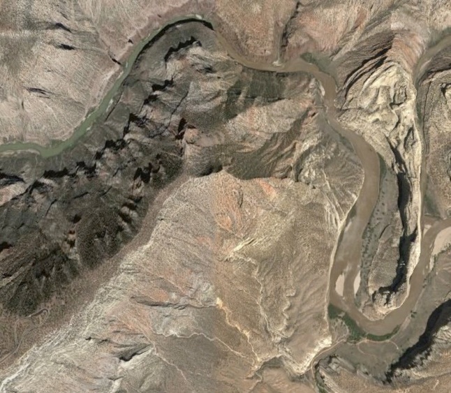
Google Earth shows this area clearly:
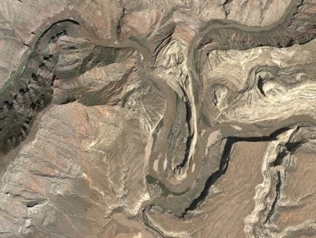
The long narrow white-topped feature that runs vertically in the center of the photo above is Steamboat Rock. The Green River enters the photo in the upper right-hand corner, flows around the southern end of Steamboat Rock, then back north, and finally exits the photo at the left flowing southwest.
The Yampa River enters the photo at the right center, and then joins the Green to the right of Steamboat Rock.
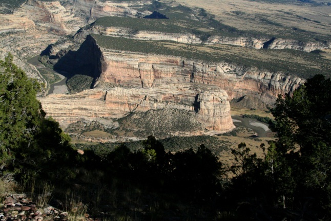
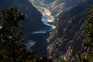
The photo below was taken from Harper's Corner Trail, which is a spectacular two-mile round trip walk. In this photo, Steamboat Rock runs left to right in the center of the picture. The Green River can be seen to the right of Steamboat Rock, as it flows around its southern end. The Yampa River enters behind Steamboat Rock, in the upper left portion of the photo, just to the left of the large shadow:
This is a closer shot, showing the Yampa as it flows toward Steamboat Rock, which runs left to right in the foreground. It joins the Green out of sight behind Steamboat Rock:
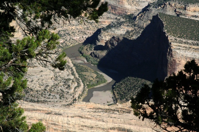
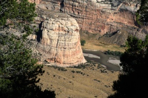
The photo below shows the southern end of Steamboat Rock with the Green River to the right. This valley area is called Echo Park. ("Park" is a generic name for a flat valley like this.) We feel that this is an area that we must return to, so that we can drive the dirt road to Echo Park:
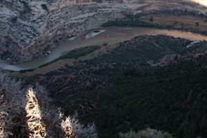
A small portion of the Green can be seen in the lower center of this photo, as it flows toward Steamboat Rock in the foreground:
This photo shows the Green as it flows right to left, in front of Steamboat Rock:
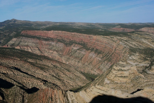
Let's return to Google Earth Photos. In the photo below, Steamboat Rock is to the far right. Notice the darker colored, more densely vegetated area to the left of center. This is an area of steep cliffs that drop off to the Green River. Since much of the area faces north, it receives less direct sunlight, and larger trees can grow here. But the rocks here are also darker, as they are made from limestones and shales, rather than the sandstone of Steamboat Rock:

Here's a photo of this area, known as Whirlpool Canyon, taken from Harpers Corner Trail:
There are lots of these red rocks along the trail:
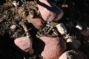
They are made of hard sandstone called quartzite, which is also found at the very bottom of Whirlpool Canyon, where the Green has begun to cut into a quartzite layer, which lies below the limestone and shale that compose the promontory. They are generally round, which indicates that they tumbled in water for a long time. So how did they get way up on top of the promontory? Your research assignment is to find out how.
Naw, I'll give you a theory. Quartzite forms much of the Uinta Mountains to the west. They may have washed down from there long before the Green cut Whirlpool Canyon.
Below is the same Google Earth photo as shown above. Notice the distinct line of demarcation between the darker green area described above and the lighter green area that appears to be nearly flat. This lighter green area is the promontory that was used as a corral, and where the Harpers Corner Trail now travels. The lighter areas to the right of the promontory are cliffs that drop off to the Green to the east:
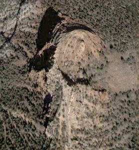
If you look carefully in the photo above, you can see the Harpers Corner Trail parking lot in the lower left-hand portion. Oh, heck, I'll enlarge it for you:
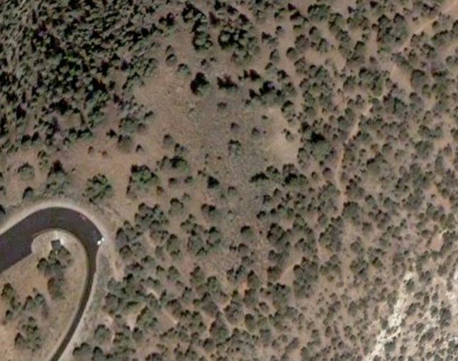
We're not sure what the two bright spots are at the end of the parking lot. (Headlights on a truck?) Let's pretend it's a truck. Follow the headlight beams and you will see the trail. The trail makes a bend near the bottom of the photo, and then exits the photo at the top right. The light stuff in the lower right-hand corner is probably exposed rock.
In the photo below, the parking lot can be seen in the lower left-hand portion. The trail can be seen as it meanders down the center of the promontory, and then on the left edge:
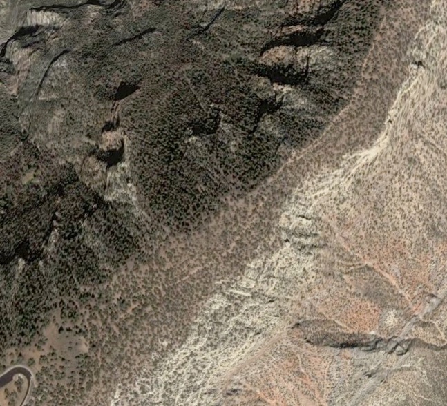
We're not sure if the trail goes all the way to the roundish butte at the top of the photo below. The drawing in the trail guide seems to show that it does, but since we don't have a topo map, we can't be sure:
Here's our Harper's Corner Trail album:


