Carroll’s Photos


2007/09/23 continued
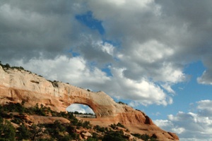
On the way to our campsite near Monticello, Utah, US 191 passes close to Wilson Arch:
2007 Camping Trip
Page 8


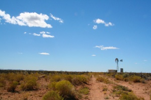
After leaving Hovenweep, we saw this lonely windmill:
We then drove into Arizona and camped at Cottonwood Campground at Canyon de Chelly National Monument (da-SHAY).
2007/09/25
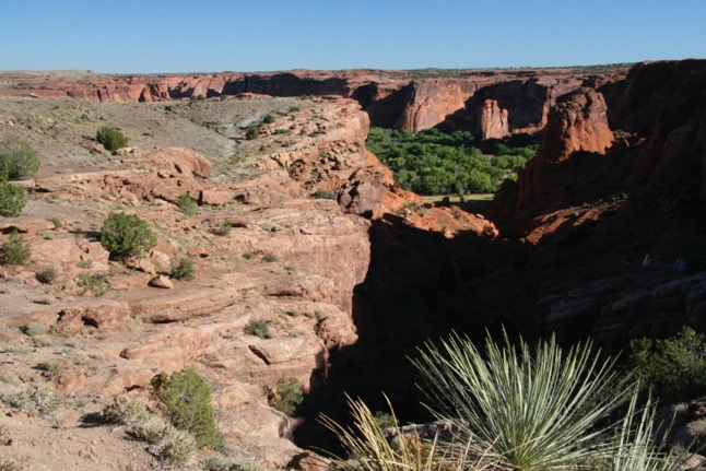
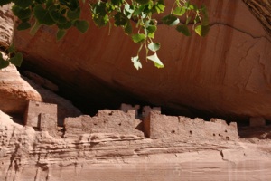
Canyon de Chelly is really several canyons, including Canyon de Chelly, Canyon del Muerto, and others. At the mouth of the canyon, the walls are only 30 feet high, but to the east the walls reach more than 1,000 above the floor. At White House Ruin, which was occupied until about 1300 A.D., the canyon is about 500 feet deep. Here's a view from the rim:
After the Anasazi left, migrating Hopi Indians spent the summers farming here. The Navajo arrived about 300 years ago. Their small corn fields, small fruit orchards, and traditional hogans still dot the canyon floor.
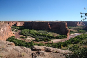
Our White House Ruin Trail Album takes you round trip on this 2.5-mile trail, beginning with views from the rim:
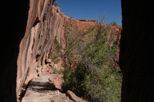
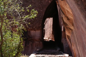
There is a tunnel near the top of the trail. This photo shows the view as you emerge from this tunnel:
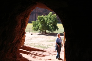
This tunnel is at the canyon floor:
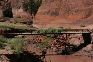
Although we have been to Canyon de Chelly many times, we have hiked to White House Ruins only once. Back then, Chinle Wash meandered around on a relatively flat canyon floor. Now it has cut a channel deep enough so that a bridge is required to cross:
The lower ruin:
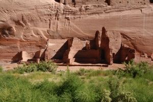
The upper ruin:
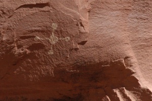
There are petroglyphs on the canyon walls near the ruin:
The photos after the petroglyphs were taken on the trail back to the rim. The photo below shows the entrance to the tunnel at the top. Just before we reached this point we heard the jingle jangle of many bells. All of a sudden a trip of goats emerged from the tunnel, with a Navajo boy following soon behind. (I don't know…. That's what Infoplease calls them….) They were gone before I could ask if I could photograph them:
Our White House Ruin Trail Album follows:
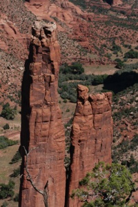
We drove on to the end of the road where there are views of 800-foot high Spider Rock:
Uh, oh. We've run out of photos (almost). We drove to Flagstaff and spent the night at our Kachina Village house, before returning to Litchfield Park. There was a bit of fall color there:
We camped at Dalton Springs Campground, where we had camped about 32 years earlier. On the road to the campground there were deer and turkey everywhere. We pulled into a long pull-through site. We don't think the campground has changed at all.
We were the only campers there. At first it was a bit spooky, as vehicles were slowly driving through, presumably to look for wildlife at a nearby meadow. (The campground is on a loop road.)
2007/09/24
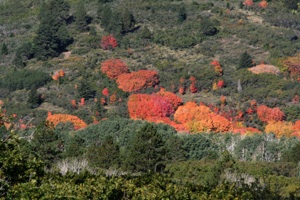
When we left the campground in the morning, we drove on some side roads to take photos of maple trees showing their fall colors:
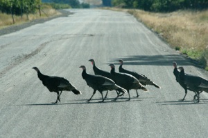
We had to stop for turkeys crossing the road:
Our stop today was Hovenweep National Monument, an unusual archaeological site. Since the Utah AAA road map shows no roads to the national monument, I printed some Google maps prior to leaving Arizona. Luckily, there were small directional signs, because, after the first couple of turns, nothing matched the Google maps. We began to wonder if there would be signs on the return trip, directing us out of the maze. (Hee, hee….)
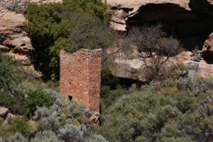
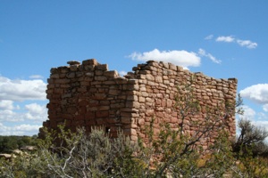
The largest site at Hovenweep, the Square Tower Group, is built in and around Little Ruin Canyon, a "Y"-shaped canyon. Square Tower, for which the group is named, is a three-story tower built on a boulder at the head of the canyon:
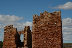
As many as 500 people may have occupied the Square Tower Group between 1200 and 1300 A.D. The number of towers built here is a distinguishing characteristic of the site:
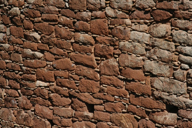
This close up shows a predominant construction technique:
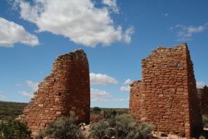
Some towers are round while others are square:
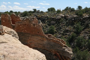
A two-mile loop trail drops down into the canyon to cross from one side to the other; otherwise, it follows the canyon rim to offer excellent views of all structures:
Some structures were built on isolated or irregular boulders or rock outcroppings:
There are other small groups of buildings, called "outliers," but due to heavy recent rains, the dirt roads to these sites were not passable.
Here's our Hovenweep album:


