Carroll’s Photos


2007/09/20 continued
As we drove back to US 40 I said. "Do we want to backtrack about 35 miles and camp at Dinosaur or go on about 105 miles to Colorado National Monument?" It was now rather late in the afternoon, but we decided to go on even though we knew we would arrive after dark.
All was going rather well, and we were making good time, only having to slow down a bit for an occasional curve. Then we came upon a 35 mph sign. "Why is that sign way out here?" Well, a short distance down the road we found out why. One curve followed another and pretty soon we were driving 270-degree curves at 15 mph. Kinda like some of the roads they have in the North Carolina mountains. Or as C.W. McCall would have said, it looked like a can of worms.
I said to Julia, "I thought this road looked pretty straight on the map." I asked her to turn on the light and take a look. She said there was only one squiggle in it. Finally we reached the top and then there was more of the same going down the other side. By some miracle we found the turn off into Colorado National Monument. (The sign was rather small.)
We wound up to the top of the plateau and pulled into the campground. Luckily there were some sites that were more or less wide spots in the road, and we pulled into one of those. Nearly everyone had gone to bed. Julia took the flashlight and went to the sign-up board to pay. Pretty soon her flashlight was coming back. "Good evening," it said in a baritone voice. (It wasn't Julia.) Hee, hee….
2007/09/21
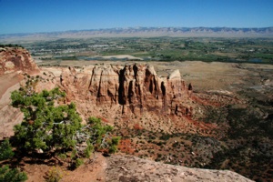
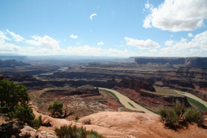
In the morning we woke up to views like this, with irrigated land along the Colorado River and the mountains we had driven across the night before on the horizon:
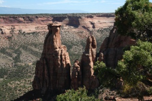
We visited the visitor center and drove Rim Rock Drive, stopping at all the overlooks:
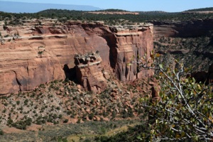
We like the way this big chunk of rock crunched down all in one piece:
Here's our album:
2007 Camping Trip
Page 7


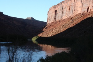
Our next stop was Arches National Park, via Interstate 70 and Utah 128. After a short distance, Utah 128 began to follow the Colorado River, down in the canyon. We think this is one of the most beautiful roads we have ever driven. I couldn't see much, but every once in a while I got a glimpse of deep blue sky, red rock canyon walls, and gorgeous reflections in the water:
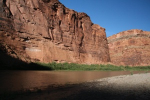
We stopped where we could, but mostly it was canyon wall on the left and drop off into the river on the right. There are a few campgrounds along the way. Some day we would like to return and drive the road at daybreak and at dusk, noting the best spots; then, on subsequent days, hike to them:
Here's our album:
We camped in Moab so we could enter Arches National Park early in the morning.
2007/09/22
When we were planning our visit to Arches, we were surprised at how accessible many of the arches were. We planned to hike to eleven arches, plus Balanced Rock, in a single day.
The arches began to form when faults deep in the earth formed cracks in the top layer of sandstone. Rain seeped into the cracks; ice formed, expanding and breaking off pieces of rock. Wind also played a role. Natural bridges, on the other hand, are formed by running water.
When we drove up to the entrance station, we were told that there was one site for our type of vehicle. (It was a Saturday.) We were told to look for a site that had a smiley face on its post. We found the site easily, and saw other smiley faces that appeared to identify tent sites. After you pay at the pay station, you drop your ticket stub into the post and it covers up the smiley face.
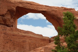
First up was Skyline Arch, which is near the campground. Round trip is .4 mile:
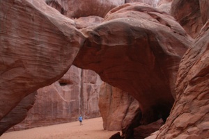
Sand Dune Arch is aptly named. The .4-mile round trip trail is through deep sand:
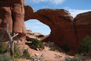
The trail to Broken Arch was also sandy, but not nearly as deep as the trail to Sand Dune Arch:
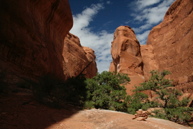
After we had explored the area around the arch for a while, taking photos from different angles, I suggested that we continue on the loop that went through a "fin" area. "Fins" are thin slabs of sandstone, stacked up side by side. They are the result of the faulting I mentioned earlier.
Finally we reached the fin area:
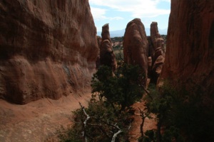
Up until our stop at Broken Arch, high clouds had mostly blocked the sun. It was farther than we thought to reach the fins, and the high clouds moved away. We began to wonder if it was going to get too hot for us to hike to all 11 arches. Luckily, thunderstorms soon moved in, blocking the sun and moderating the temperature.
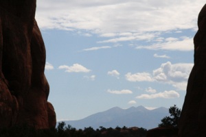
The La Sal Mountains framed by fins:
Good thing someone put this rock cairn here; otherwise we might be tempted to go left or right. (Hee, hee….)
The loop that we took totaled two miles. We think a better way would be to hike to Broken Arch, then backtrack to this sign:
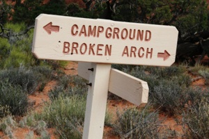
If you hike from this sign toward the campground, you almost immediately enter the fins. Explore there as much as you wish, then return to the sign, and finally to the parking lot.
Our Broken Arch Trail album:
There are two trails for Delicate Arch. The trail guides are a little vague about the length of the trail we took. It's at least a mile round trip, but I think I probably walked farther. Julia stopped at the end of the developed trail, while I hiked on over solid rock. The route was obvious, but it was also marked by dilapidated rock cairns.
After walking out on the solid rock I took this shot of Delicate Arch:
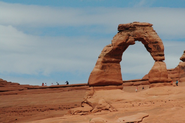
Lots of people there … doesn't look like it will take long to get there….
Well, maybe we have a problem here….
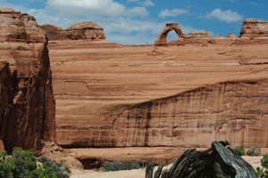
We had decided to take the shorter viewpoint trail, since the trail to the base of the arch is three miles round trip.
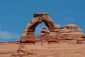
The farther I hiked, the more sky I could see through the arch. This shot was taken early on:
Here's our Delicate Arch album:
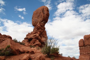
The trail that encircles Balanced Rock is only about .3 mile long:
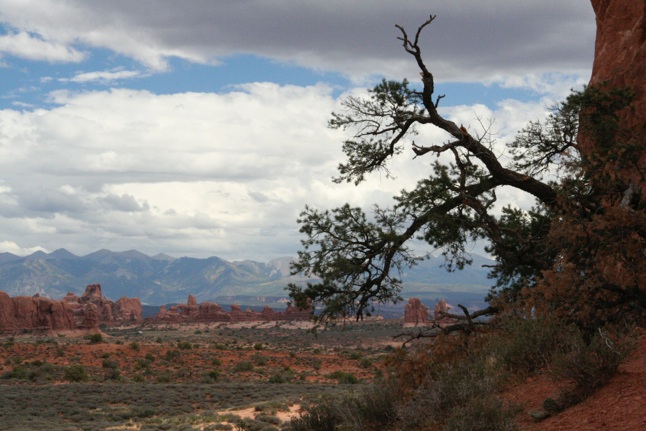
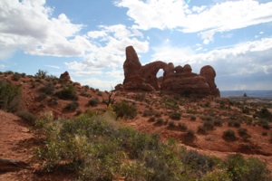
If you look carefully at the sandstone formations in the distance, Turret Arch can be seen about half way between the tree branch and the left side of the photo. If you can’t spot it here, you should be able to see it in the Album below:
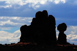
I love these silhouette shots:
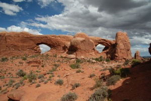
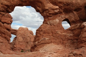
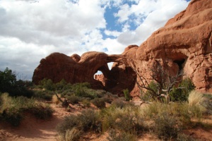
One trail, about a mile round trip, leads to North Window, South Window, and Turret Arch. In this photo, North Window is on the left:
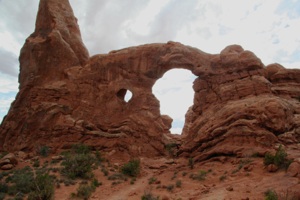
When you stand in the vicinity of the Windows, and turn around, you will have a view of Turret Arch like this:
Here's another view of Turret Arch. What the heck…. I must have flipped the photo left to right…. No, just kidding. I walked through Turret, and took the photo from the other side. South Window can be seen through the opening:
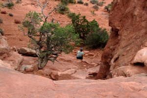
Julia decided to sit out the walk under Turret Arch:
This view of Turret was taken from a different trail, the trail to Double Arch:
Here's our album for these three arches:
This is Double Arch (Round trip is .5 mile):
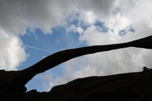
So far, thunderstorms had been in the area keeping it cool, but had not been right overhead. Now we were about to begin a longer trail (2 miles) to Landscape Arch, and it looked like we would be heading right into a storm. I put the camera into its case, and we headed out.
We weren't going to miss this arch: it's longer than a football field, and it's really thin, so who knows when it's going to collapse. (Hee, hee….) The wind was pretty fierce, sometimes blowing sand in our face and sometimes pelting us with light rain. The clouds were constantly on the move.
When we got to the end of the trail I waited for the wind and rain to stop, then yanked the camera out. Click, click, click. I repeated this several times, hoping to get some blue sky under the arch:
On our way back to the parking lot, we took side trips to Tunnel Arch and Pine Tree Arch. Here's an album with photos of these arches, plus some other photos taken throughout the day:
We had barely returned to our campsite and set up when the storm really let loose. It rained most of the night.
2007/09/23
Utah's Dead Horse Point is a short distance from Arches National Park. This Google Earth Photo shows the point clearly:
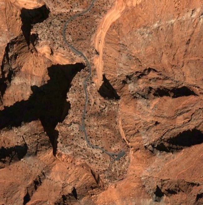
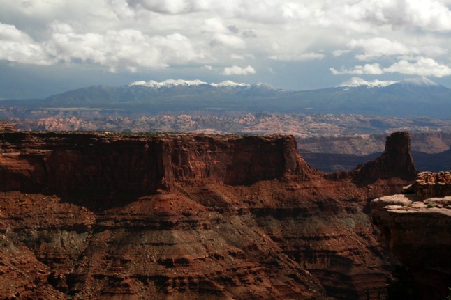
The "neck" of the point is only about 30 yards across. We parked at the neck and hiked the perimeter of the point, all the way around. Views in all directions are phenomenal. The storm that gave us rain most of the night at Arches dumped snow on the higher elevations:
The legend of Dead Horse Point goes like this: Cowboys would herd mustangs onto the point, then coral them there by fencing off the neck with limbs and brush, like this:
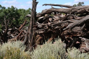
The mustangs were then roped and broken, with the better ones being kept for personal use or sold to eastern markets. The brush fencing was then breached so the culls could return to the open range. For some unknown reason, the mustangs remained on the point one year, where they died of thirst.
Here's a view of the Colorado River Gooseneck, 2,000 feet below:
We think you will enjoy this album of Dead Horse Point:
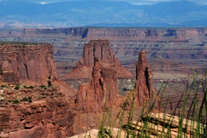
We spent only a few hours at Canyonlands National Park, where there are spectacular views as well:
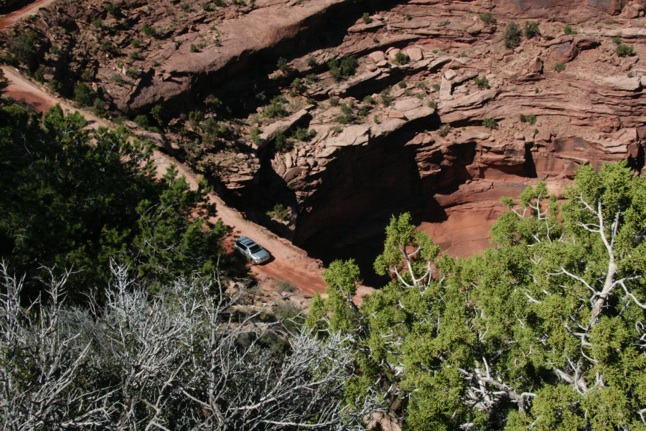
We hope to return some day and drive the 100-mile White Rim Road, a route for four-wheel-drive vehicles, even though the National Park Website has this warning:
Drive Carefully!
Towing charges are very expensive. Visitors caught in the backcountry with disabled vehicles can expect towing fees in excess of $1,000.
Hee, hee….
Here's a vehicle heading out on the White Rim Road:
We visited Mesa Arch:
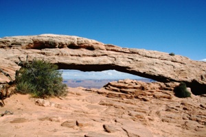
This photo shows the shadow of Mesa Arch in the canyon below:
Our Canyonlands album:


